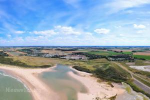
Medieval roots and the name Nieuwvliet
A village called Nieuwvliet already existed here in the Middle Ages, first appearing in the records as Nieuvliet in 1514.
- Meaning of the name: a vliet is a stream or watercourse, and the word nieuw (new) distinguished this water from an older vliet nearby.
- Monks from Ghent: in the Middle Ages the monks of St Peter's Abbey in Ghent were busy diking this area, which is how St Peter, locally called Sinte Pier, became the patron saint of the region.
- Islands and sea inlets: the area lay between the former islands of Cadzand and Groede, in a landscape of creeks, salt marshes and channels constantly threatened by the sea.
- Lost to the water: in the 16th century the medieval village disappeared beneath the waves after a series of floods.
Jan Adornes and the village of Sinte Pier
In 1527 the Bruges merchant and polder builder Jan Adornes (also Adornis) had the Sint Janspolder diked and founded the manor of Nieuwvliet there.
- A manor of standing: the new manor also included the older manors of Sint Pieter and Mettenije, was recognised by Emperor Charles V in 1529 and received its own charter of no fewer than 164 articles in 1530.
- The village of Sinte Pier: around a chapel dedicated to St Peter grew the village of Sinte Pier, also called Oud-Nieuwvliet, which lay some distance west of the present village.
- Links with Ghent: the chapel later became a parish church, with the right of patronage held by St Bavo's Abbey in Ghent.
- St Felix's Flood (1530): after only a few years the dykes lost the battle, St Felix's Flood swept over the young village and rebuilding took years.
- Destroyed by war: a few decades later Sinte Pier was lost once more, this time not to the sea but to soldiers during the Eighty Years' War.
The Groote Sint Annapolder and a new beginning
In 1602 the Groote Sint Annapolder was drained, and in it, a few kilometres east of the old chapel, today's Nieuwvliet grew up.
- A redoubt in the polder: Spanish troops built an earthen fortification in the new polder, which was named Sinte Pier after the vanished village.
- Dutch territory (1604): after the campaign of Prince Maurice of Orange in 1604 the redoubt and the village fell to the troops of the Dutch Republic, and Nieuwvliet became part of States Flanders.
- High manor: Nieuwvliet remained a high manor with its own court of justice, passing from the Adornes family to, among others, the Borssele van der Hooge and De Vos families; in 1790 Johannes Faro bought it as its last lord.
- Elongated shape: with the draining of the Kleine Sint Annapolder in 1698 the territory gained its characteristic elongated shape, completed by polders such as the Mettenijepolder, Adornispolder, Baenstpolder and Lampsinspolder.
Reformed Protestants and Mennonites
Around 1650 the polder consisted of two hamlets: Nieuwvliet, where the Reformed Protestants lived, and Sinte Pier, home to the Mennonites.
- Mennonite church (1656): the Mennonites of Sinte Pier were the first to build their own church, in 1656.
- End of a congregation (1777): the Mennonite congregation of Sinte Pier was dissolved in 1777 after most members had left, and its possessions went to Aardenburg.
- Other faiths: Catholics and Salzburg emigrants, Protestant refugees from Austria, also found a place in the polders around Nieuwvliet.
- Sinte Pier lives on: the name of the vanished village can still be heard; many locals call Nieuwvliet Sinte Pier, its residents are known as Sintepiere, and every summer the Sinte Pierse Feesten are celebrated.
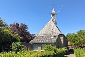
The French period and a municipality of its own
The French invasion of 1794 brought an end to manorial rights and to centuries of rule by the lords of the manor.
- Annexed by France (1795): on 1 October 1795 the area was annexed by France, returning to Dutch rule only in 1814.
- Small but independent: Nieuwvliet became a municipality of its own, which had 830 inhabitants in 1840 and was so small that it often shared a mayor with neighbouring Groede.
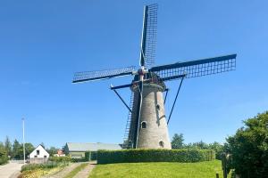
The Verdronken Zwarte Polder
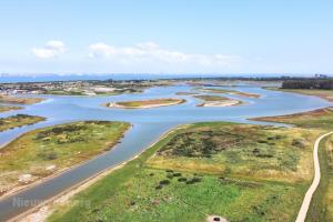
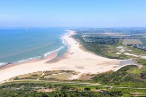
One of the finest reminders of the battle against the water is the Verdronken Zwarte Polder (Drowned Black Polder), which was lost in a flood in 1802.
- Diked in 1623: the Zwarte Polder was created in 1623, but in the flood of 1802 the sea broke through again.
- Half reclaimed: after the disaster only part was reclaimed for farming, the area where the De Zwarte Polder campsite lies today, among other things.
- A rare tidal inlet: the other part developed into a slufter, a tidal area behind the dunes where salt water flows in through a gully at spring tide, with salt-loving plants and many birds.
- Related to the Zwin: similar areas can be found in the Zwin, the Slufter on Texel and the De Westhoek nature reserve in De Panne.
- Fossils in the sand: with a bit of luck you will find fossil shark teeth on the beach by the Verdronken Zwarte Polder, remains of a warm sea from millions of years ago.
The Second World War and the liberation
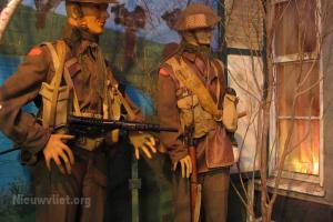
During the Second World War Nieuwvliet lay right in the area liberated by Canadian troops in the autumn of 1944 during Operation Switchback.
- Atlantic Wall: the German occupiers fortified the entire coast of western Zeeuws-Vlaanderen with bunkers and obstacles to prevent an Allied landing.
- Liberation in autumn 1944: in October and early November 1944 Canadian units liberated the polders south of the Westerschelde; near Cadzand the last German stronghold in western Zeeuws-Vlaanderen surrendered on 2 November.
From polder village to seaside resort
In the 20th century more and more holidaymakers discovered the wide beach near Nieuwvliet, and from that tourism Nieuwvliet-Bad grew.
- Nieuwvliet-Bad: unlike Cadzand-Bad, Nieuwvliet-Bad is not a real village but a collective name for the campsites, bungalow parks and holiday parks behind the dunes.
- Municipal reorganisation: in 1970 the municipality of Nieuwvliet was merged into Oostburg, and since 2003 the village has been part of the municipality of Sluis.
- Small village, big summer: Nieuwvliet-Dorp has around 400 inhabitants, but in summer that number is exceeded many times over by the guests in Nieuwvliet-Bad.